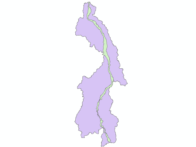
Limite nappe alluviale rivière Allier (SAGE Allier Aval) - 2007
Simple
- Date (Publication)
- 2013-06-11T00:00:00
- Identifier
- FR-254-502-008_EPL-LIMITENAPPEALLUVIALE
- Presentation form
- Digital map
- Status
- Completed
- Maintenance and update frequency
- Not planned
- Place
-
- SAGE
- Allier
- aval
- nappe alluviale
- GEMET - INSPIRE themes, version 1.0
-
- Hydrographie
- Use limitation
- Aucune condition ne s’applique
- Access constraints
- Intellectual property rights
- Use constraints
- Intellectual property rights
- Spatial representation type
- Vector
- Denominator
- 50000
- Metadata language
- fre
- Character set
- UTF8
- Topic category
-
- Inland waters
))
- Reference system identifier
- EPSG / RGF93 / Lambert-93 (EPSG:2154) / 7.4
- Distribution format
-
-
ESRI Shapefile
(
1.0
)
-
ESRI Shapefile
(
1.0
)
- OnLine resource
-
Site internet de la DREAL Auvergne : www.auvergne.developpement-durable.gouv.fr/
(
WWW:LINK-1.0-http--link
)
Site internet de la DREAL Auvergne : www.auvergne.developpement-durable.gouv.fr/
- OnLine resource
-
epl_limitenappealluviale.zip
(
WWW:DOWNLOAD:ESRI Shapefile
)
Fichier au format Shapefile
- OnLine resource
-
EPL_2007_limitenappealluviale
(
OGC:WMS
)
Limite nappe alluviale rivière Allier (SAGE Allier Aval) - 2007(OGC:WMS)
- OnLine resource
-
EPL_2007_limitenappealluviale
(
OGC:WFS
)
Limite nappe alluviale rivière Allier (SAGE Allier Aval) - 2007(OGC:WFS)
- Hierarchy level
- Dataset
Conformance result
- Date (Publication)
- 2010-12-08
- Explanation
- Degré de conformité de la ressource par rapport aux spécifications visées d'Inspire (Conforme, Non Conforme, Non Evalué)
- Pass
- No
- Statement
- Issu de cartes géologiques au 1/50 000
- File identifier
- efa0dc48-a378-4374-85aa-71cf57ec4006 XML
- Metadata language
- fre
- Character set
- UTF8
- Hierarchy level
- Dataset
- Date stamp
- 2020-12-07T09:01:10
- Metadata standard name
- ISO 19115:2003/19139
- Metadata standard version
- 1.0
Overviews

Spatial extent
))
Provided by

 DatARA