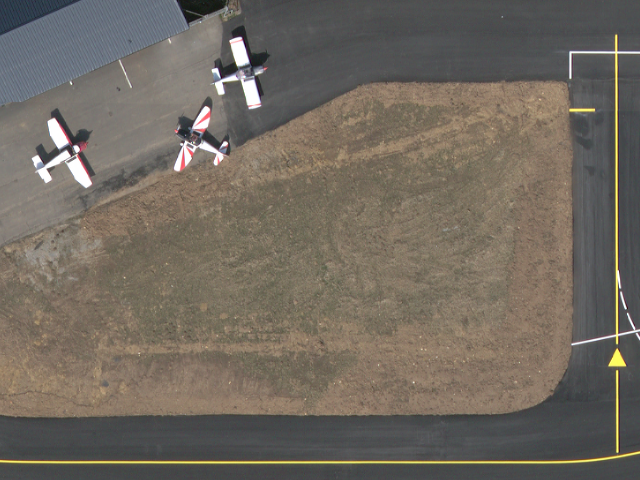
Orthophotographie couleur "express" - Agglomération d'Aurillac - PVA hiver 2014
Simple
- Date (Publication)
- 2014-09-15
- Identifier
- CRAIG_IGNF_FEDER_OrthoCABA_express_5cm_2014
- Name
- IGNF_ORTHOHR_1-0.xml
- Issue identification
- Produit
- Purpose
- Le produit est destiné à une exploitation numérique pour un usage technique. Il peut être utilisé pour un usage de communication, en recourant, le cas échéant, aux fonctionnalités d'édition des couleurs et des contrastes des outils de traitement d'images numériques.
- Status
- Completed
04 73 40 75 61
Point of contact
04 73 40 75 61
04 73 40 75 61
- Maintenance and update frequency
- As needed
- Name
- JP2
- Version
- 1.0
- Theme
-
- ortho-imagerie
- CABA
- communauté d'agglomération du bassin d'Aurillac
- RTGE, PCRS
- GEMET - INSPIRE themes, version 1.0
-
- Ortho-imagerie
- Communes de France
- Communes de France
- Use limitation
- Mentions obligatoires : © IGN – Partenariat RTGE Auvergne – 2014, convention n° IGN 400 00460
- Spatial representation type
- Grid
- Distance
- 0.05 m
- Metadata language
- Français
- Character set
- 8859 Part 15
- Topic category
-
- Imagery base maps earth cover
- Description
- Ensemble de dalles image
))
- Geographic identifier
-
http://xml.insee.fr/schema/cog.xsd#xpointer(//*[@name='Code_Région_stype']
)
/
83
/
2006
- Date (Publication)
- 2015-05-20
- Geographic identifier
-
http://xml.insee.fr/schema/cog.xsd#xpointer(//*[@name='Code_Département_stype']
)
/
15
/
2006
- Date (Publication)
- 2015-05-20
- Description
- Emprise temporelle de la prise de vue qui est entrée dans la réalisation de l'orthomosaïque
- Unique resource identifier
- RGF93 Lambert-93
- Codespace
- urn:ogc:def:crs:IGNF:1.1
Spatial representation info
- Distribution format
-
-
JP2
(
1.0
)
-
JP2
(
1.0
)
Distributor
- Fees
- Voir IGN et Centre Régional Auvergnat de l'Information Géographique
- Ordering instructions
- Voir site internet www.ign.fr
- OnLine resource
-
ortho_express_caba
(
OGC:WMS-1.1.1-http-get-map
)
Orthophotographie "express" hiver 5 cm CABA
- OnLine resource
-
dallage_caba_A
(
OGC:WMS-1.1.1-http-get-capabilities
)
Dallage Bloc A
- OnLine resource
-
dallage_caba_B
(
OGC:WMS-1.1.1-http-get-capabilities
)
Dallage Bloc B
- OnLine resource
-
dallage_caba_C
(
OGC:WMS-1.1.1-http-get-map
)
Dallage Bloc C
- OnLine resource
-
dallage_caba_D
(
OGC:WMS-1.1.1-http-get-map
)
Dallage Bloc D
- OnLine resource
-
dallage_caba_E
(
OGC:WMS-1.1.1-http-get-capabilities
)
Dallage Bloc E
- Hierarchy level
- Dataset
Conformance result
- Date (Publication)
- 2010-11-23
- Explanation
- Non évalué
- Pass
- Yes
- Statement
- Les données ont été produites dans le cadre de partenariat visant à expérimenter l'imagerie aérienne comme fond de pla très grande échelle pour les exploitants de réseaux sensibles.
Content Information
- File identifier
- 9f79ec45-eaa1-4903-936d-a9617657ed07 XML
- Metadata language
- Français
- Character set
- UTF8
- Hierarchy level
- Dataset
- Hierarchy level name
- Lot
- Date stamp
- 2023-09-14T09:29:00.701034Z
- Metadata standard name
- ISO 19115
- Metadata standard version
- 2003 Cor.1:2006
04 73 40 75 61
Overviews

Spatial extent
))
Provided by

 DatARA