 DatARA
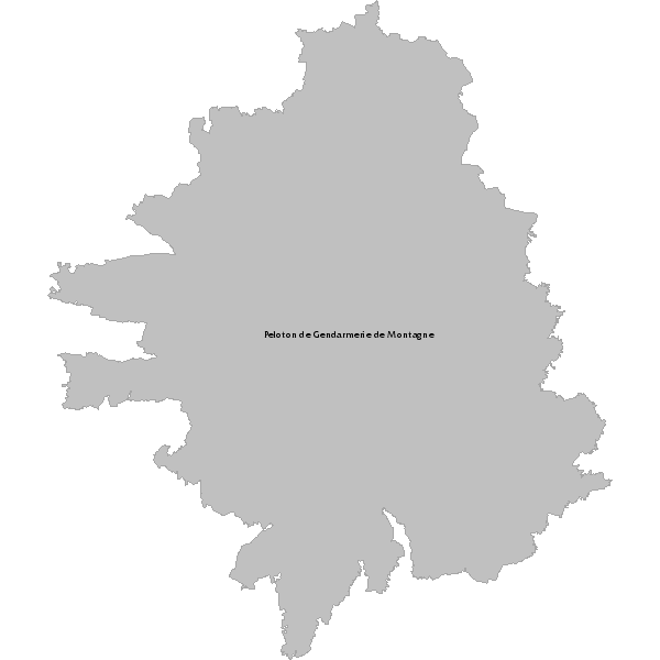
Gendarmerie zone d'intervention du peloton de montagne (Cantal)
Zone d'intervention du peloton de montagne de Murat
Simple
- Date (Publication)
- 2012-06-14T14:31:00
- Date (Revision)
- 2012-06-14T00:00:00
Custodian
DDT 15 (Direction Départementale des Territoires du Cantal)
-
LAVERGNE Jean-Jacques
04 63 27 66 45
- Place
-
- Cantal
- Gendarmerie
- Peloton de montagne
- Theme
-
- DDT 15 (Direction Départementale des Territoires du Cantal)
- Domaines
-
- Administratif
- Gestion de crise
- DDT Cantal
- Spécification départementale
- Access constraints
- Restricted
- Use constraints
- Copyright
- Spatial representation type
- Vector
- Metadata language
- fre
- Character set
- UTF8
- Topic category
-
- Intelligence military
- Description
- Cantal
N
S
E
W
))
- Reference system identifier
- EPSG / RGF93 / Lambert-93 (EPSG:2154) / 7.4
- Hierarchy level
- Dataset
- Feature catalogue citation
- File identifier
- 01c1d4f6-4a65-47d5-a5e1-a754efbd033c XML
- Metadata language
- fre
- Character set
- UTF8
- Hierarchy level
- Dataset
- Date stamp
- 2023-02-02T16:49:20
- Metadata standard name
- ISO 19115:2003/19139
- Metadata standard version
- 1.0
Point of contact
DDT 15 (Direction Départementale des Territoires du Cantal)
-
LAVERGNE Jean-Jacques
(
chargé de mission SIG
)
22 rue du 139è RI
,
BP 10414
,
Aurillac
,
Cantal
,
15000
,
France
04 63 27 66 45
Overviews
large_thumbnail
thumbnail
Spatial extent
N
S
E
W
Provided by

Associated resources
Not available